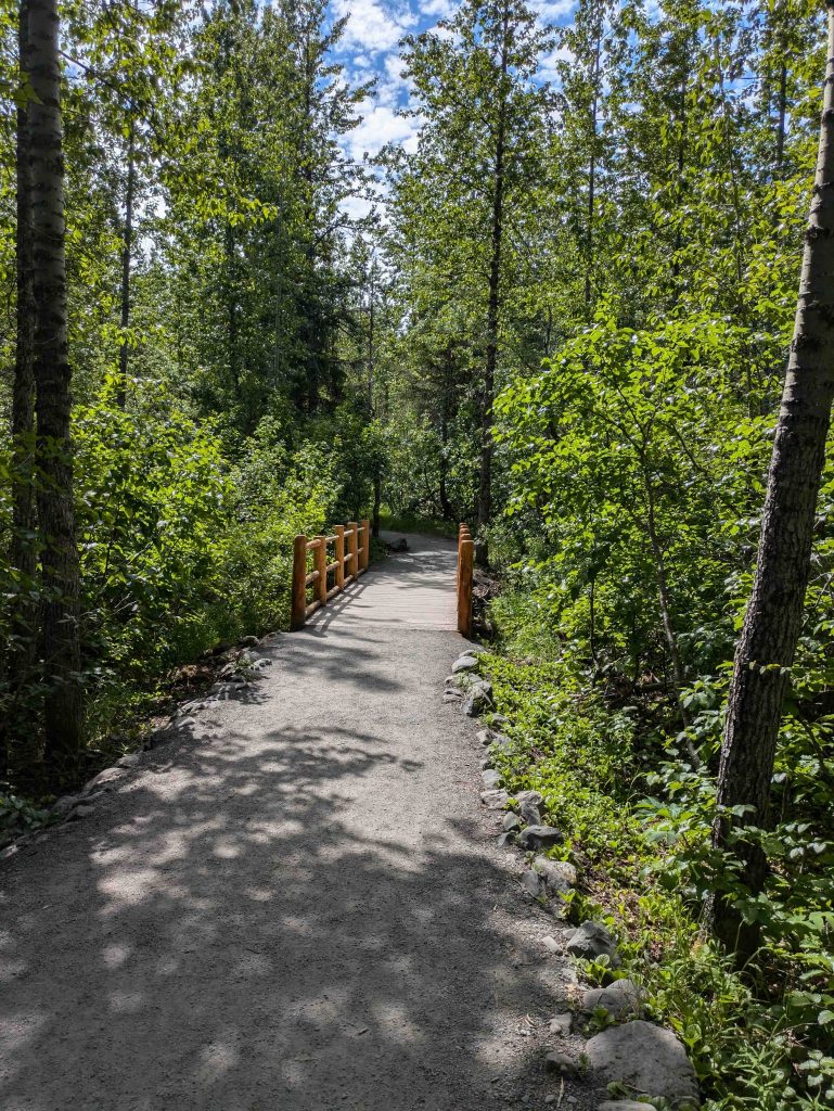
As we ventured on, it seemed like we were alone – there was no crowd around us, and for a few minutes, it was just the 4 of us walking through paths surrounded by trees on either side.
“Maybe we will see a bear.”
“You have the bear spray to handle it.”
“Yeah, but it’s inside my backpack. Not the place where it should be if we have to use it.”
We kept talking as we went along – that is also one of the recommendations in bear territory! To make noise while walking so that bears don’t come near.
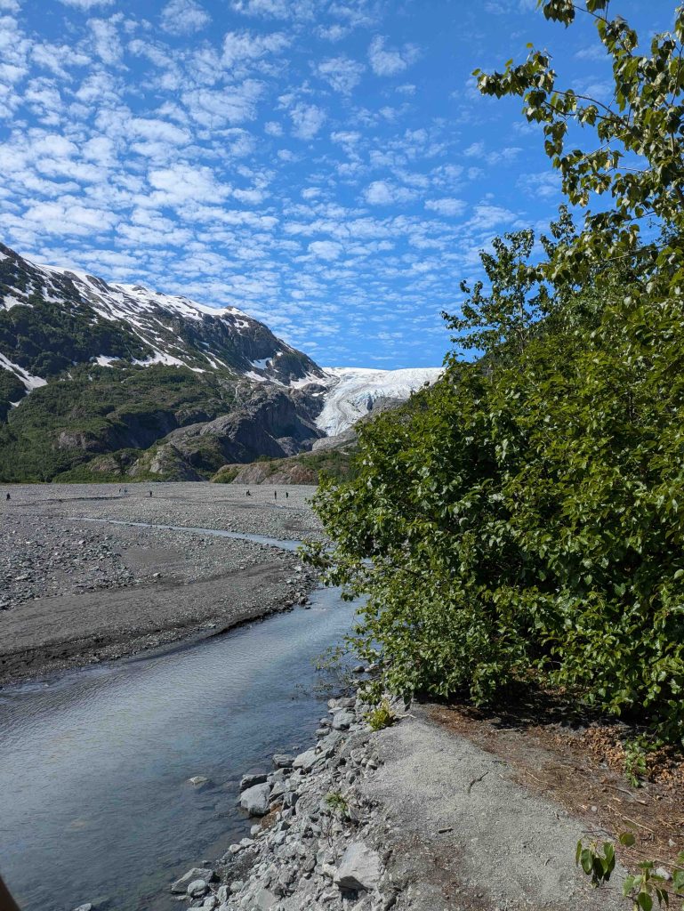
The path led us to a water stream – it was Raghav’s practice and became my practice as well that when we encountered water bodies, we’d test their temperature – we dipped our hands in, and it was cold.
There is an audio guide available: https://www.alaska.org/guide/exit-glacier-guide
Some interesting tidbits – like we don’t pay much attention to the ground that we are walking on – that we can spot moose and bear scat around. As you walk on the trail, you see certain milestone-type markers with a number on them – first 1917, then came 1926 and so on. At first, we thought it might be the elevation, but later learned that it was the year the glacier was present on that spot.
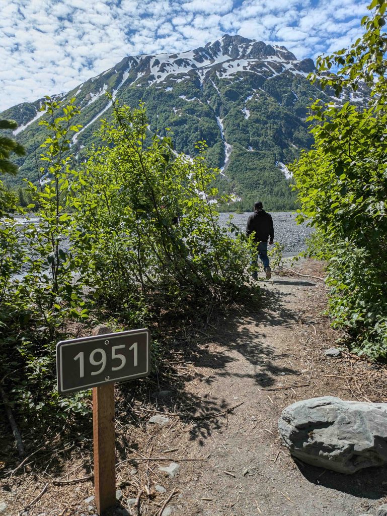
These spots were now solid land with the glacier not even close by – so fast has been the retreat/shrinking of the glacier. It also explained why in certain random places near the trees there would be a large rock – seemed a little out of place, but these were boulders that were carried by the glacier – glacier is moving ice, and as it moves, it carries things along with it.
There was a nice bench carved in a log to provide a resting point on the trail; we finally saw a few other people ahead of us.
“Moorthy, your knee ok? Or you want to sit here?”
“I’m fine, man.”
I saw a board which said we were at the end of the ‘Glacier View Trail’.
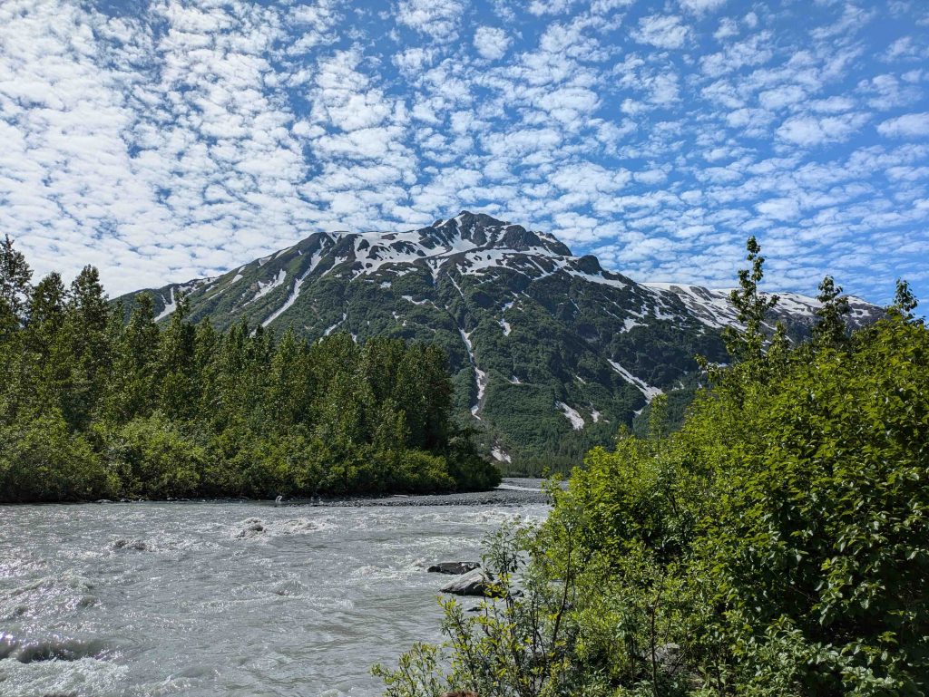
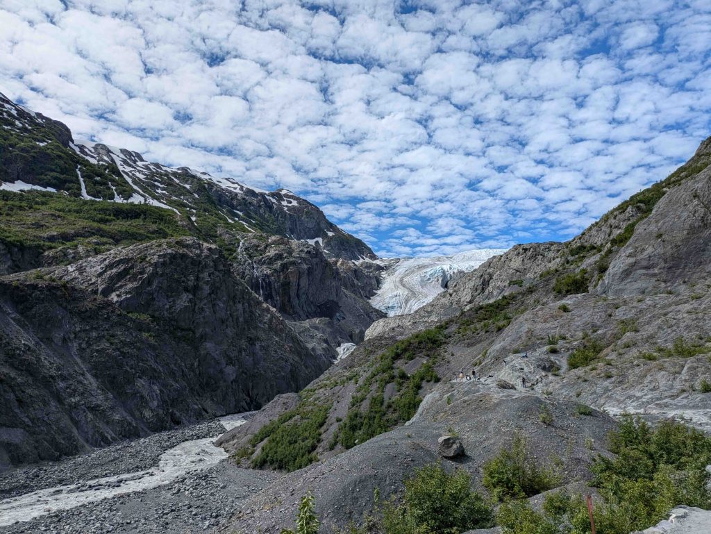
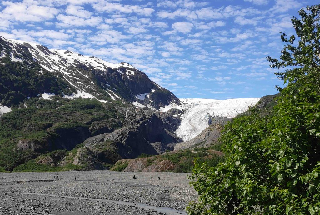
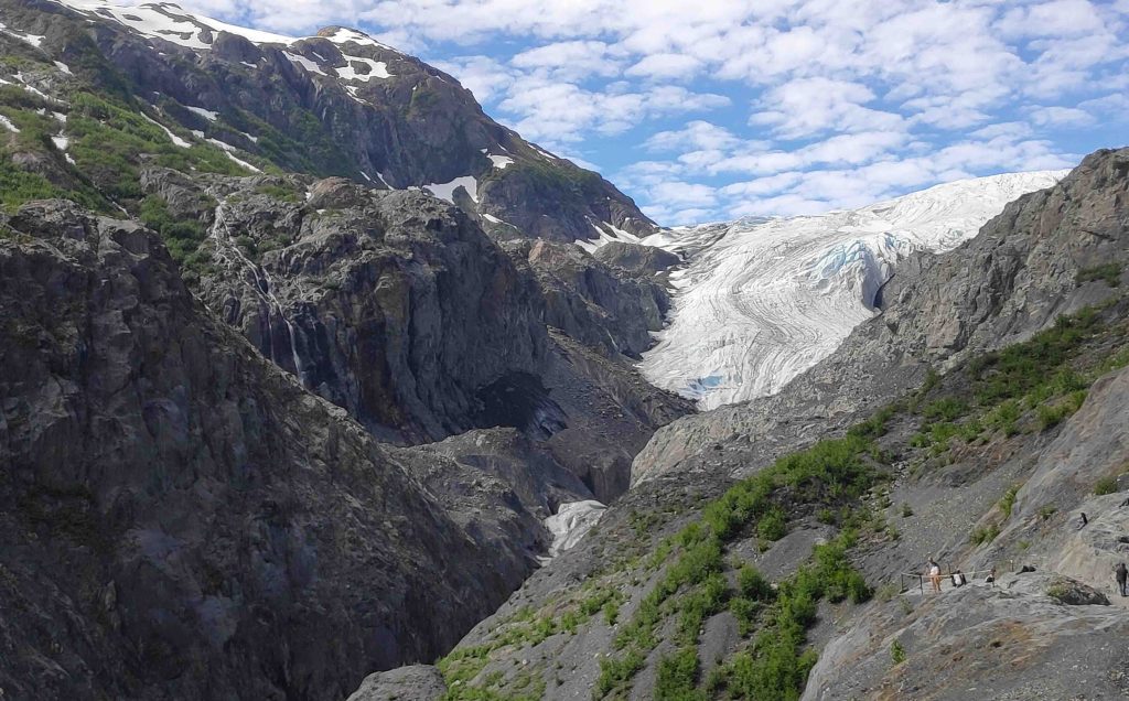
At this point, we had a good view of the Exit Glacier. The glacier was this stretch of ice between the sides of two mountains, seeming to flow through a valley. Some glaciers start carving the mountainside of the valley walls, and that’s how Fjords are created. Exit glacier is moving at 20 inches a day or so, but it’s losing about 24 inches a day – Exit Glacier is a ‘retreating glacier’ meaning it is losing more than what it is gaining (and for a glacier to form, it’s not the amount of snow in winter that matters, but how much of that snow stays till the end of the summer that matters – and over decades the glacier forms; this is called an ‘advancing glacier’).
Rakesh and Moorthy didn’t see the board signalling the end of the trail. We just kept walking along the trail, and I didn’t bring anyone’s attention to the board. The alternative was that we could have stepped down to walk on the plain (called outwash plain) that was at the base of Exit glacier – the stream of water was narrow at this point, and people were walking onto the plain – from here it felt like we could walk on the plain and hike up to the base of the exit glacier.
“It’s flat but rocky. And there’s a long distance to walk to get near the glacier.”
Rocky surface wouldn’t be good for Moorthy’s knee.
“Let’s just continue on this trail path.”
Unknown to both of them, we were now on the longer and moderate difficulty trail – the Glacier Overlook Trail.
Why do glaciers move? A board had the answer – the Harding ice field gets some 70 feet of snow each year, and the weight of the snow powers the glaciers.
We couldn’t see the ice field from down below – need to get more elevation for that. We did have a thought about walking up to the edge of the glacier, but saw a board that talked about “Chasing a glacier” – a receding glacier uncovers terrain that can be unstable and hence even if it seems that you can get close, it may not be safe to do so – projections from the glacier could collapse without warning.
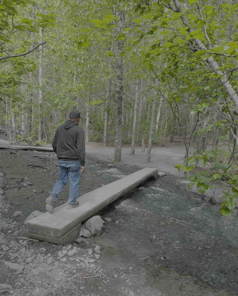
There was a place where we had to cross a small stream – on one side was a slightly wobbly plank to get across. Raghav and I gingerly walked on it.
“Moorthy, be careful on this.”
But he found a more stable board a few feet away!
We reached another rest area, where they had built a hut-like shelter. We paused to sip water before continuing.
Further along, we hit upon a steep climb.
“Hey, this is not the first trail,” Rakesh said when he noticed a board that mentioned the name of the trail. “Yeah, we are on the longer one.”
Rakesh probably wasn’t too happy about this, but he wasn’t surprised either – Raghav and I had the habit of pulling along people on long walks without them even realising how long it would be (another 5 mins or another 10 mins we’d keep saying and soon it would be an extra 45-minute walk!)
“Moorthy ok with going up? If not, we can make a dash up and come back here.”
“That side seems a little less steep,” and he went a few feet away to climb up the rocks.
There was a larger crowd here, and a person was leading a guided walking tour.
We weren’t in hiking shoes, but we were able to manage this longer trail. It takes you closer to the exit glacier and to a higher viewpoint. The milestone board said 2005. We sat on the rocks for a while, then made our way back. There was a point at which the board said “Harding Icefield Trail” – the longest trail, which was certainly tempting, but we skipped it.
We left the place at around 1:45 pm; no bear or moose encounters!
Exit glacier ice hiking details (where you will literally walk on the glacier) – https://www.exitglacierguides.com/content/ice-hiking